UK Postcode Guide
Shipping to and between Great Britain, Northern Ireland, and the surrounding sovereign islands poses a unique challenge for shipping rate providers. While Shopify does a good job at breaking down UK postcode areas, they do not address more granular and commonly used outward codes. That’s what we’re here for!
The UK Postcode map
In order to tame complex UK Shipping configurations, we’ve provided a mapping tool to visualize exactly where your current price restrictions apply. Any time you have a UK-specific restriction selected a globe icon will appear on the right of the input box. Click the globe icon to open the mapping tool.

Continue reading to learn more about how this tool helps you view and select rates!
UK Specific Restrictions
To help define UK shipping areas intuitively, we provide two restrictions on Prices:
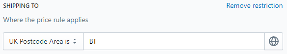
UK Postcode Area (is/is not)
This restriction will allow you to define (or restrict) a price that applies to a broad geographic area of the UK such as BT for Northern Ireland or DG for Dumfries and Galloway.

Below is an example restriction that defines this price rule is only for the BT area:
 Here is the same restriction viewed via our shipping area picker:
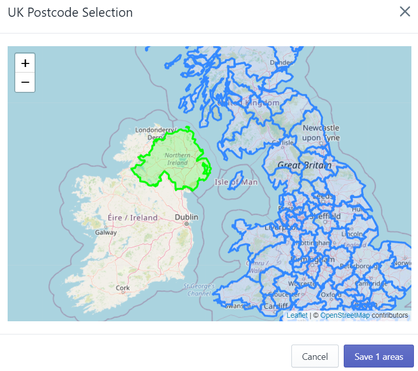
You can use this map to view and edit your postcode area list. Simply click the “Save Areas” button in the bottom-right to apply your changes!
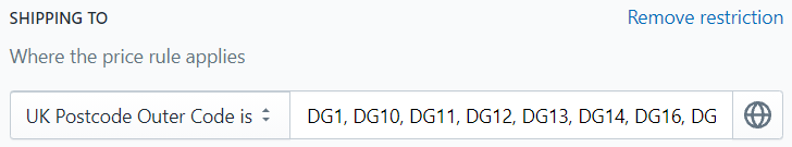
UK Postcode Outward code (is/is not)
With this restriction, you have more granular control over where the corresponding price applies by providing the postcode area, district, and subdistrict. This block of information in a UK postcode is more commonly referred to as the outward code - hence the name!

Below is an example restriction that includes several sections of the DG area:
Here is the same restriction viewed via our Outward Code picker:
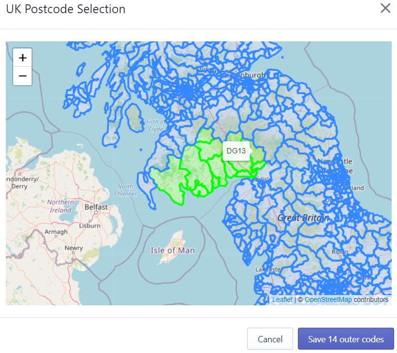
You can use this map to view and edit your postcode outer code list. Simply click the “Save Outward Codes” button in the bottom-right to apply your changes!
Where are Northern Ireland Outward codes?
Isle of Man?
You may notice while BT and IM are shown on our map as valid UK Postcode Areas, they do not appear on our outward code picker. Unfortunately, the Open Map data we have does not specify Northern Ireland or Isle of Man with the same granularity it does mainland UK.
However, we assure you that any outward codes you enter into our UK Postcode Outward Code is / is not restriction will filter shipping addresses as expected. Though this is a shortcoming of our map display, the system we built to compare shipping addresses with your destination restrictions works as expected.
How do I define mainland UK?
You may notice when you select postcode areas for Truro or Portsmouth, our map will automatically highlight several islands and additional areas. Though this is technically correct - these islands are part of their corresponding postcode area - we recognize shipping can be drastically different when parcels must travel over water.
The easiest workaround to provide mainland UK shipping is to design each shipping price you want to provide as two. One restricted to the bulk of Mainland UK and the same price again, but restricted to those outward codes that are still on land.
For your convenience, here are completed postcode lists you can copy and paste right into our app:
Please note: if you are using Parcelify Universal Shipping, the following lists will need to be broken into separate prices with restrictions less than 300 characters.
Price 1:
UK Postcode Area is:
AL, B, BA, BB, BD, BH, BL, BN, BR, BS, CA, CB, CF, CH, CM, CO, CR, CT, CV, CW, DA, DD, DE, DG, DH, DL, DN, DT, DY, E, EC, EH, EN, EX, FK, FY, G, GL, GU, HA, HD, HG, HP, HR, HU, HX, IG, IP, KT, KY, L, LA, LD, LE, LL, LN, LS, LU, M, ME, MK, ML, N, NE, NG, NN, NP, NR, NW, OL, OX, PE, PL, PR, RG, RH, RM, S, SA, SE, SG, SK, SL, SM, SN, SO, SP, SR, SS, ST, SW, SY, TA, TD, TF, TN, TQ, TS, TW, UB, W, WA, WC, WD, WF, WN, WR, WS, WV, YO
Price 2:
UK Postcode Outward Code is:
AB10, AB11, AB12, AB13, AB14, AB15, AB16, AB21, AB22, AB23, AB24, AB25, AB30, AB39, AB99, KA1, KA10, KA11, KA12, KA13, KA15, KA16, KA17, KA18, KA19, KA2, KA20, KA21, KA22, KA23, KA24, KA25, KA26, KA29, KA3, KA30, KA4, KA5, KA6, KA7, KA8, KA9, PA1, PA10, PA11, PA12, PA13, PA14, PA15, PA16, PA17, PA18, PA19, PA2, PA3, PA4, PA5, PA6, PA7, PA8, PA9, PH1, PH2, PH3, PO1, PO10, PO11, PO12, PO13, PO14, PO15, PO16, PO17, PO18, PO19, PO2, PO20, PO21, PO22, PO3, PO4, PO5, PO6, PO7, PO8, PO9, TR1, TR10, TR11, TR12, TR13, TR14, TR15, TR16, TR17, TR18, TR19, TR2, TR20, TR26, TR27, TR3, TR4, TR5, TR6, TR7, TR8, TR9
Additional Areas
We do our best to keep our documentation as relevant and up-to-date as possible. If you see a common UK shipping area not on this list, please let us know at support@parcelify.com!